
The Future Is Aerial
Application by Drone was created to bring practical aerial application services to South East Queensland properties — especially farms, acreage blocks, rural land, commercial sites and rehabilitation areas where steep ground, wet paddocks, gullies, fence lines, disturbed soil and difficult access can make conventional equipment unsafe, slow or impractical.
Our Journey
Application by Drone was built around a simple idea: there are many properties and worksites where the job still needs to be done, but the ground conditions make it hard to get machinery in safely.
Across South East Queensland, landholders and contractors deal with steep country, wet paddocks, lantana, pasture weeds, fire ant concerns, rough boundaries, creek lines, regrowth, erosion areas, disturbed land and sites that are difficult to reach with tractors, quad bikes, boom sprayers or ground rigs.
Drone technology gives landholders, contractors and project managers another option.
Using agricultural drones and mapping equipment, Application by Drone provides support for aerial spraying, spreading, seeding, baiting, mapping, rehabilitation support and treatment planning. The goal is not to replace good farm management, professional agronomy advice, environmental consultants or project specifications — it is to provide a safer, more practical way to access, treat and record areas that are difficult to manage from the ground.
Real-World Solutions
Application by Drone focuses on practical results in the paddock and on site.
Drone application can assist where ground equipment may bog, damage pasture, create wheel ruts, struggle on steep slopes, disturb newly prepared rehabilitation areas or simply cannot reach the target area safely. This makes drone work useful for rural properties, acreage blocks, grazing country, developers, councils, civil contractors, environmental consultants and land-management organisations.
Our services can support:
- aerial spraying and spot spraying
- pasture and broadacre treatment support
- lantana and woody weed treatment support
- seed, fertiliser and granular spreading
- fire ant bait application where approved and suitable
- paddock and property mapping
- weed extent mapping
- before-and-after treatment records
- hard-access, wet-ground and steep-country work
- mine rehabilitation support
- disturbed-land revegetation
- erosion control seeding
- rehabilitation fertiliser and soil amendment spreading
- mapping and monitoring for rehabilitation areas
Every job starts with the site. We look at the target area, access, terrain, hazards, weather, nearby sensitive areas, livestock, people, water sources, product requirements and whether drone application is the right fit.
For rehabilitation and disturbed-land work, we also consider the project specification, soil stability, erosion risk, site access rules, environmental requirements and whether aerial spreading or mapping can support the required outcome without unnecessary ground disturbance.
Our Equipment
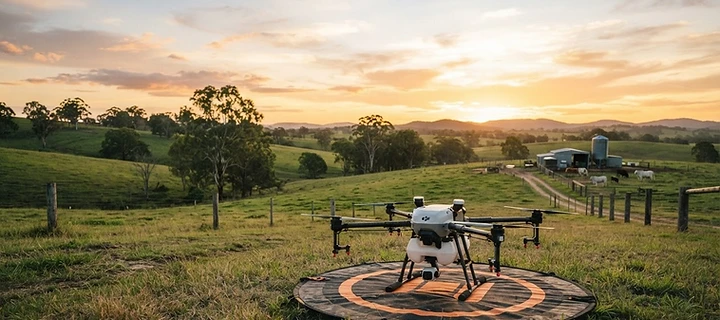
Application by Drone uses the DJI Agras T100 agricultural drone for heavy-lift spraying and spreading work, supported by DJI Mavic 3 mapping capability for planning, inspection and treatment records.
The T100 allows aerial application over suitable areas where ground access may be limited, while mapping support helps measure paddocks, define treatment zones, identify hazards, inspect difficult-access areas and provide clearer job records.
This combination gives landholders, contractors and project managers a more practical way to plan, treat and record work across difficult or hard-to-access country.
Mine Rehabilitation & Disturbed-Land Support
Application by Drone can assist with aerial spreading, seeding, fertiliser application, soil amendment spreading and mapping support for rehabilitation areas, disturbed land, erosion-prone sites, quarries, civil projects and mine rehabilitation programs where drone application is suitable.
Drone support may be useful where:
- ground access is limited
- terrain is steep, uneven or unstable
- vehicle access could damage newly prepared rehabilitation areas
- soil disturbance needs to be reduced
- seed or fertiliser needs to be spread over hard-access ground
- mapping is needed for planning, progress records or before-and-after reporting
- weed pressure needs to be mapped or managed across rehabilitation zones
This work must be completed in line with the project specification, environmental requirements, product labels, site rules and relevant approvals.
Application by Drone does not replace environmental consultants, mine rehabilitation specialists or project managers. We provide practical aerial application and mapping support to help complete the work where drones are the right tool for the site.
Our Approach
We are not here to make big claims or promise magic results.
Application by Drone is built around careful planning, honest assessment and practical aerial application support. Not every job is a drone job. Some weeds, sites, products or rehabilitation requirements may need ground-based treatment, mechanical control, cut-stump methods, erosion-control works, specialist advice, follow-up treatment or a broader integrated management plan.
Where drone application is suitable, we aim to provide a safe, efficient and well-planned service that helps landholders and project managers get work done with less ground disturbance and better access to difficult areas.
Our Mission
Our mission is to help South East Queensland landholders, contractors and land managers complete spraying, spreading, baiting, mapping and rehabilitation-support jobs more safely and efficiently using practical drone technology.
We exist to support farmers, acreage owners, councils, developers, civil contractors, environmental consultants and land managers with aerial application options for real-world property and project challenges: wet paddocks, steep terrain, difficult access, lantana, pasture weeds, fire ant baiting, mapped treatment areas, disturbed land, erosion areas, rehabilitation zones and tight seasonal windows.
We are not here to replace farmers, agronomists, environmental consultants or land managers — we are here to give them another tool for getting difficult jobs done properly.
Get a Quote