
Solutions – How Application by Drone Delivers Practical Aerial Application Support
Application by Drone combines heavy-lift drone application with aerial mapping, careful planning and practical property access solutions for farms, acreage properties, rural landholders, councils, developers and land-management organisations across South East Queensland.
Using the DJI Agras T100 and DJI Mavic 3 mapping drone, we can assist with spraying, spreading, seeding, baiting, mapping and treatment planning in areas where conventional ground equipment may be difficult, unsafe or impractical.
Our Core Equipment & Capability
DJI Agras T100 – heavy-lift agricultural drone
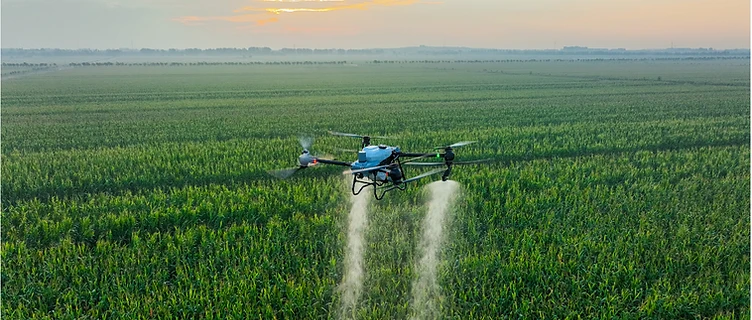
Used for aerial spraying and granular spreading across suitable farms, paddocks, acreage properties, steep country, wet ground, gullies, fence lines and hard-access treatment areas.
Spraying capability
Suitable for approved aerial application work including weed spraying, spot spraying, pasture weed treatment, lantana and woody weed support, fence-line spraying and difficult-access vegetation treatment where the product, site, label and conditions allow.
Spreading capability
Suitable for approved granular spreading work including seed, fertiliser, lime, soil amendments, pasture renovation products, fire ant bait and other approved granular products where the product and site are suitable for drone application.
DJI Mavic 3 mapping drone
Used for property mapping, paddock measurement, weed extent mapping, access planning, treatment-area marking, before/after records and inspection support.
Mapping and treatment planning
We can assist with identifying treatment areas, measuring hectares or acres, checking access constraints, marking hazards, planning take-off zones and preparing job records.
Digital job records
Where required, work can be supported with mapped treatment areas, application notes, before/after imagery and job records for landholders, councils, developers and land-management clients.
End-to-End Workflow
A practical process from property details to completed job records
- 1
Quote & Site Review
Send through your property details, location, target area, photos, maps or treatment requirements. We review access, area size, terrain, likely job type and whether the site is suitable for drone work.
- 2
Mapping & Planning
Where required, we use aerial mapping to measure paddocks, mark boundaries, identify hazards, check access, define treatment zones and plan the safest and most efficient approach.
- 3
Product & Compliance Check
Application By Drone does not recommend specific chemicals, products or rates. Product selection, application rate, withholding periods and use pattern must follow the approved product label, permits and relevant requirements.
- 4
Mobilisation
We arrive with the drone, support equipment and job plan. Access, take-off area, weather, water supply, livestock, people, neighbours, sensitive areas and site hazards are checked before work starts.
- 5
Execution
Spraying, spreading, seeding, baiting or mapping is completed according to the approved job scope, weather conditions, label requirements and site assessment.
- 6
Records & Follow-Up
After the job, we can provide mapped treatment areas, job notes, application records, photos or follow-up recommendations where required.
Typical Applications
Where Drone Application Helps
Drone application can be useful where:
- ground equipment may bog or damage paddocks
- steep country makes tractor or quad access unsafe
- gullies, fence lines or rough boundaries are difficult to reach
- paddocks need treatment after rain but vehicle access is limited
- targeted application is needed over mapped problem areas
- fire ant bait or granular products need to be spread across larger or awkward areas
- landholders need mapping, records or treatment-area measurement before work starts
Suitable For
- farmers and grazing properties
- acreage owners
- rural residential properties
- pasture and broadacre blocks
- steep or rough country
- wet paddocks and difficult-access areas
- commercial landholdings
- developers and civil sites
- councils and land-management organisations
- fire ant baiting support where approved and suitable
Measurable, Practical Results
Application by Drone focuses on practical outcomes:
One local operator. One practical process. Drone spraying, spreading and mapping support for South East Queensland properties.
Important Disclaimer
Application by Drone does not recommend specific chemicals, products or application rates. All spraying, spreading, seeding, baiting and treatment work must comply with approved product labels, APVMA requirements, relevant permits, withholding periods, environmental requirements, CASA requirements, Queensland biosecurity obligations and applicable chemical licensing requirements. A site assessment is required before any work is undertaken.
Ready to get started?
Get in touch today for expert advice and an accurate quote.